SOLDverkocht verkauft Originele Stafkaarten - Maps General Staff Military Section - MAPS for Military and official use
1/100,000 1/50,000, 1/40.000
1910 --------->1922
Belgique frontières - grenzen van Belgie en steden - Belgian frontiers
more than 50 maps, on linen 7 - op linnen 7, de rest niet verdoekt (in totaall ongeveer 50 stuks)
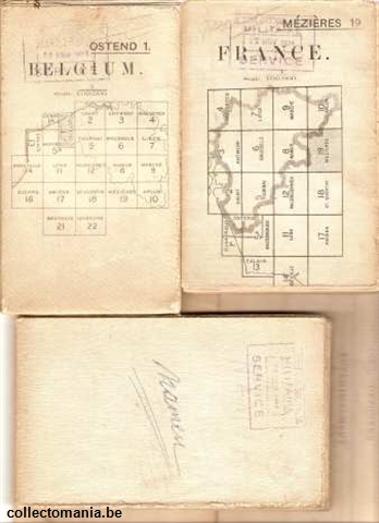
On Linen folded - sur toile - op linnen 1/100.000 verdoekt, toegeouwen : 7 Liége, 12, valenciennes, 9 Marche, 3, antwerp ed. 2 , 1a Dunkerque Belgium, Ghent 2 - Brugge coastline - Zeeuws Vlaanderen - Holland border - Hollandse grens ( neutre - neutral - neutraal ) anno 1915, 5 Tournai
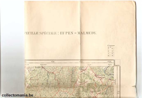
1/40.000 : 26 Reckheim, Gand-Alost, Thielt, 20 Dixmuide Roulers, 19 dunkerke-Furnes 1910, idem bigger-groter-plus grand, Bourg Léopold tres grand-heel groot 1/40.000, institut cartographique 23 Malines, , coll officiers eurpen*Malmedy, 16 LIERRE1924 2e wervingsbureel van Antwerpen,14 Lokeren, 13 Brugge, 12, Ostende, Ostende plus petit-kleiner-smaller- tres détaillé-part-stukken, 9 Arendonck, 7 Kapellen 6 april 1922, 4 blankenberghe,3 Maerle, 2 Breda-Meerle, 1 Esschen-Bergen op zoom, 24 Aerschot 26 sept. 1924, 25 Hasselt , 27 Proven - strazeele - Pradelle-Schaexken - hendeghem - Zermezele - ebblinghem - Terdeghem - Bollezeele, 28 Ypres Oyghem - lendelede, 30 Grammont - 8e regiment de ligne - 6e kompagnie nr 31 Bruxelles, 32Louvain, 33 St Trond, 35 Gemmenich, 36 Ploegsteert, 37 tournai, 38,Ath, 39 Nivelles, 40 Wavre, 42 Liège, 43 Limbourg, 44 Perruwelz, 45, Mons, 46 Charleroi, 47 Namur, 48 Huy, 49 Spa, 50 Stavelot, 51 Roisin, 52 thuin, 55 Durbuy, 56 Vielsalm, 57 chimay, 58 Beauraing, 59, st Hubert, 60 Laroche, 61 Limmerlé, 62 Cul-des-Sarts, 63 Gedinne, 64 Paliseul, 65 Neufchateau, 66, sugny, 67, bouillon, 67 bouillon- Dohan - Paliseul - vivy - Poupehan - Corbion - Nivi Chateau des Amerois 1909 coloré, 68 Arlon smaller, 68 plus grand, 69 sterpenich, 70 Villers devant Orval,71 virton, 72 Hauwald - Luxemburg - Luxembourg
All those maps are in an excellent condition and I did not want to unfold them, so they still are excellent ----- alle staff kaarten zijn in uitstekende staat en ik heb ze zelf niet geopend om de goede staat te bewaren ----- toutes les cartes sont en condition tres bien, j’ai meme pas ouvert la plupart pour les conserver en meilleurs condition
Military Issuse Map of area of Belgium Border made by the 'Institut Geographique Militaire Belge -- Belgian Military instititute Geographique
Stafkaarten werden oorspronkelijk uitgegeven uit militair oogmerk, de hoogtelijnen en alle kleine gemeenten, dorpen, gehuchten en wegen, zelfs weggeltjes komen er op voor. Vandaar dat deze oude landkaarten uitermate geschikt worden bevonden door wandelaars, wandelgroepen, fietsers, fietspaden, om de weg te vinden tussen heuvels en bergen via boswegen en kleine riviertjes en beken.
Cartes géographiques militaires sont très respectés pour voyageurs à pied et bicyclette. Toutese les petits communes, même quelques maisons sont indiqués ainsi que des petits ruisseaux et rivières. Le but était original pour la défense militaire.
These geographic maps originally designed for military purpose. They were used in wars and preparations for a parcours in mountains along small waters and rivers. Every house is indicated and any small route between and through forest are there. Therefore the maps are extremely useful for wandering and bicycling
|


stafkaarten
|

 English